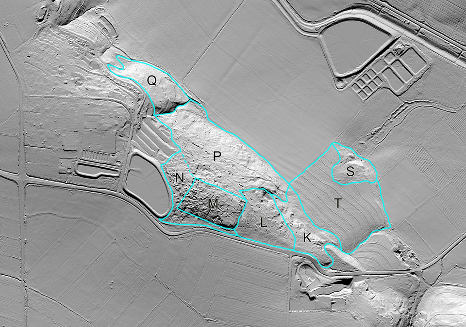
In 2012, Norma Franklin and Jennie Ebeling founded the Jezreel Expedition with the main goals of reconstructing the changing nature of settlement and the human impact on the environment of greater Jezreel in the longue dureé. We began by commissioning a LiDAR (light detection and ranging) scan of 7.5 square km of greater Jezreel and conducting a traditional foot survey of the core area, some 3 square km. The results shed light on the different settlements at Jezreel from late prehistory through the 20th century and led us to choose several areas for excavation starting in 2013.
In summer 2013, excavations in Areas S, M and K respectively revealed evidence of an Early Bronze Age settlement in a newly-identified site we named Lower Jezreel, an Iron Age building with similar architectural traits to Iron Age II buildings in the ancient Israelite capital of Samaria, and a large winery complex that may date to the Iron Age. In December, we conducted a small probe into a building or monument in Area P. In summer 2014, the Jezreel Expedition team investigated sections on an ancient path that led from the tel to the spring in Areas S and P, explored the Area P structure, which we believe to be a medieval monument, and excavated a cave located close to the winery in Area K.
Visit each season’s page to learn more about the results of that season.